So, here’s a photograph that confused me for way too long. It pops up on Baidu, when I search “深圳老照片”. It was not immediately apparent to me, however, when and where this landscape existed. And then I stumbled upon a map of Futian Commune and it was like, wow, I get it. Here’s the map:
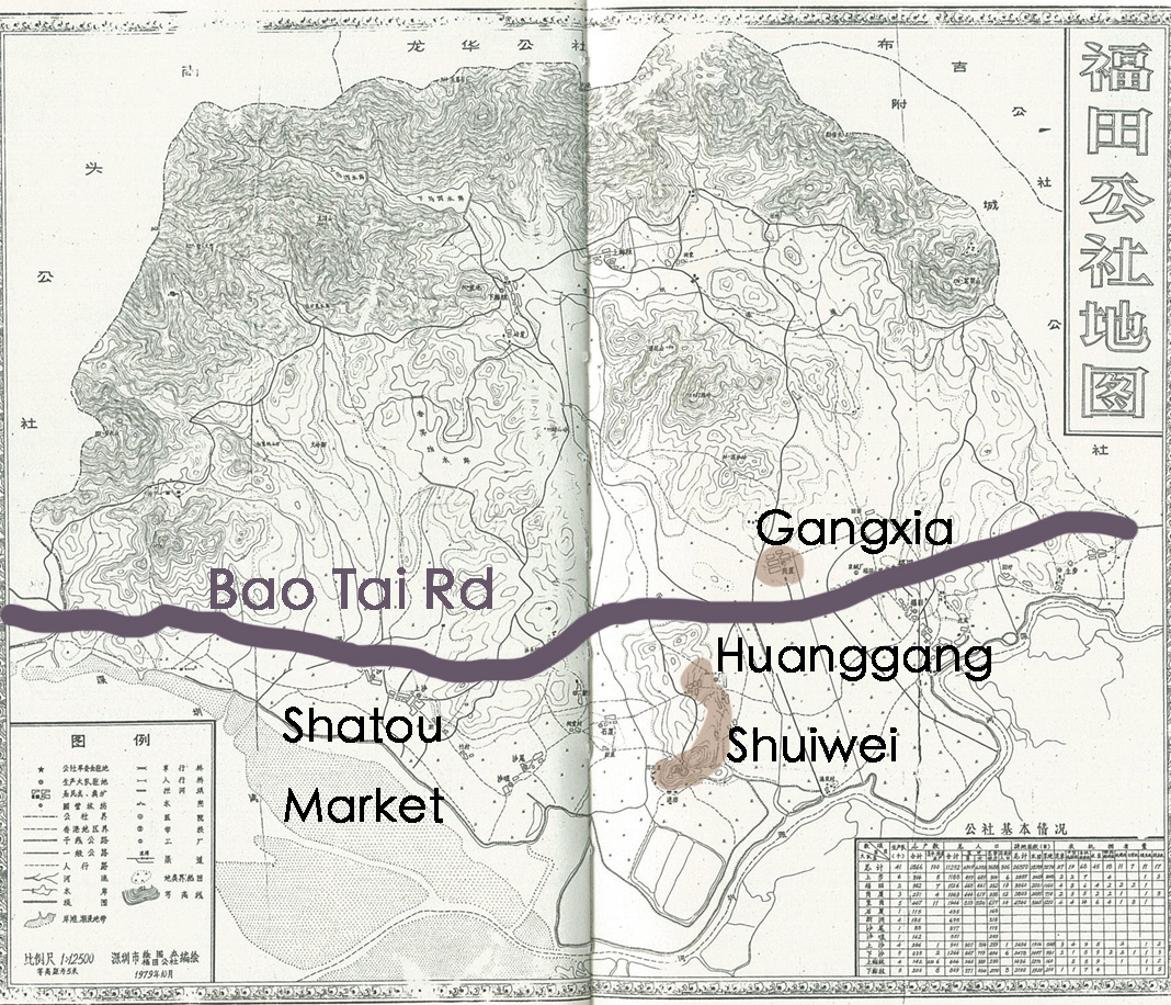
Turns out, the photo was taken from Gangxia 岗厦 (lower left hand corner of photograph), looking across Bao Tai Road 宝太公路 toward Huanggang 皇岗 and Shuiwei 水围. The key landmark is Yellow Hill 黄岗, which is now located in Huanggang Park 皇岗公园. The watery stretch behind Yellow Hill is the mouth of the Shenzhen River, where it discharges into Shenzhen Bay.
Also turns out that there’s so much to unpack when we play what’s in a name is a rose is a rose! 岗 means hill or position as in 山岗 or 岗位. ” Shuiwei 水围, which means “surrounded by water” is the original Zhuang family settlement located at the foot of Yellow HIll, where according to family genealogy a freshwater well was discovered in 1376. Over time, the Zhuangs expanded north along the foot of Yellow Hill. However, at some point in history, Huanggang Village replaced the huang meaning yellow with the huang meaning emperor and became 皇岗村, or “Emperor’s Place Village.”
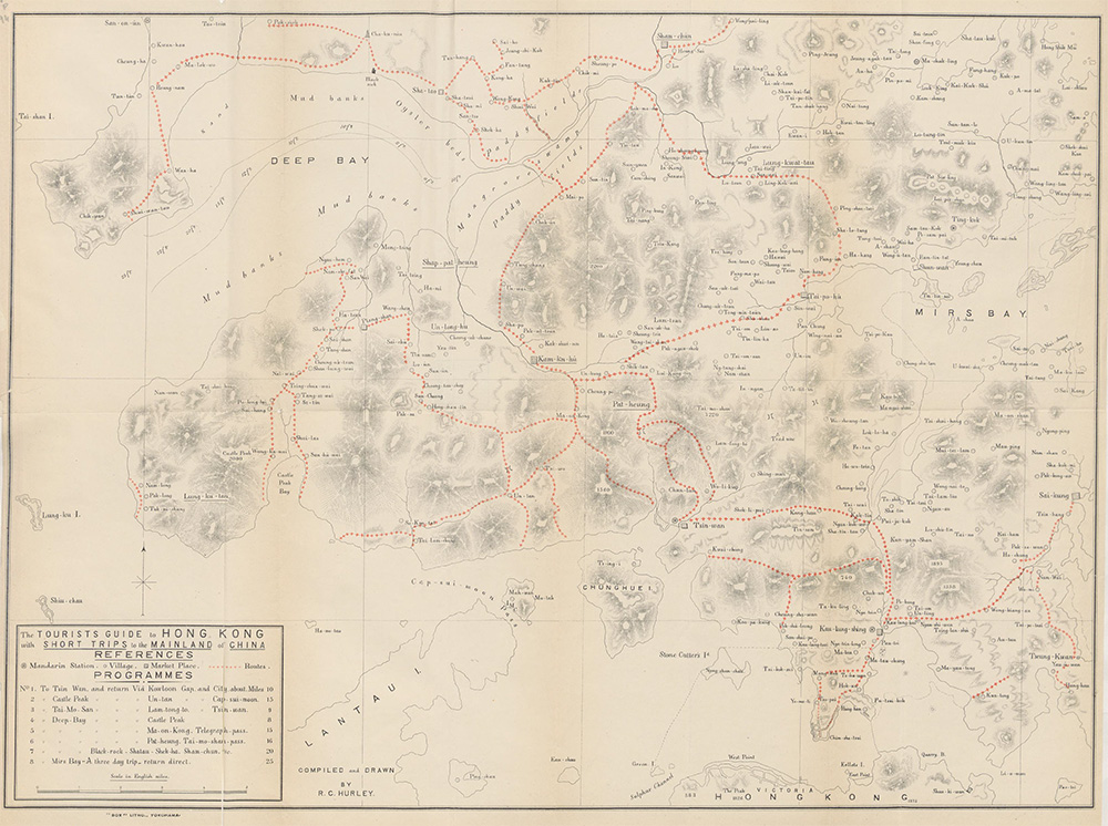
Bao Tai Road is the shortened form of 宝安太平公路–Bao’an to Taiping (in Humen, Dongguan) public road. Bao Tai Road was the forerunner of Shennan Road, which at the time of this photo was under construction in Luohu. On the map, it is clear that the road threaded through the hills of Futian as close as possible to the coastline, but safely out of the way of floods. Shatou Market 沙头墟, of course, was the main market in the area for at least several hundred years. I’ve asked around about the actual location of Bao Tai Road. Did it, for example, converge with present-day Binhai Expressway? According to older friends, no it did not. Bao Tai was part of an older mapping that included polder dikes and dirt roads. In fact, traces of this older transportation system appear in one of the first tourist hiking maps of the HK New Territories. The Tourist Guide to Hong Kong and the Mainland of China (1897) included suggestions for day trips in the Mainland, which meant taking a boat to Chiwan (at the tip of the Nantou Peninsula), Black Rock (near present-day Chegongmiao), or crossing the Shenzhen river via paddy fields.
I think the reason Liu’s 1984 photograph confused me is because by the time I arrived in 1995, most of the paddy fields along the Shenzhen River had been reclaimed as land for either the city or a new village. The only stretch of “original land” was the planned and kind of under construction Mangrove Ecological Park. By the time I saw the photograph, only the largest natural landmarks–Yellow Hill and the mouth of the Shenzhen River–still existed. The polders were under development, Bao Tai Road had been replaced by Shennan Road, and Gangxia, Shuiwei, Huanggang and other Futian Villages were already constructing the second generation of new village housing, including the first iteration of handshake tenements. Moreover, Yellow Hill was tucked away behind the all the construction sites that I passed in buses which trundled from Shenzhen University to downtown Shenzhen. After all, the 1990s were the decade when Futian began its transformation from SEZ to CBD.
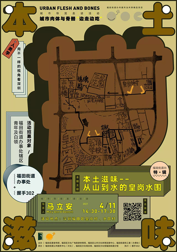
During the April 11 Flesh and Bones tour, we walked from Huanggang to Shuiwei along the foot of Yellow Hill. One of the cooler events Handshake 302 has curated.